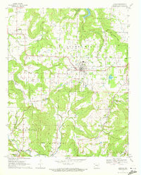
1970 Map of Lincoln
USGS Topo · Published 1972About this map
Lincoln serves as the central hub of this Northwest Arkansas landscape, where the plateau terrain of Star Hill and Rheas Mill meets the drainage of Moores Creek. The map documents a rural transition in the early 1970s, evidenced by the presence of a Substa, Sewage Disposal facility, and the Waterworks near town. To the south, the settlement of Canehill remains a focal point for genealogical research, surrounded by several family-named burial grounds including the McClellan Cem and Kidd Cem.
Find a feature on this map
46 named features on this map. Tap any name to fly to it.
Don’t see what you’re looking for? This feature index may not catch every label — zoom into the map to look around manually.
Map Details
Editions of this 1970 Lincoln Map
3 editions found
Other maps of this area

1898 · Tahlequah
USGS Topo · 1:125,000

1898 · Winslow
USGS Topo · 1:125,000

1899 · Fayetteville
USGS Topo · 1:125,000

1899 · Siloam Springs
USGS Topo · 1:125,000

1901 · Winslow
USGS Topo · 1:125,000

1901 · Fayetteville
USGS Topo · 1:125,000

1901 · Tahlequah
USGS Topo · 1:125,000

1903 · Siloam Springs
USGS Topo · 1:125,000

1904 · Siloam Springs
USGS Topo · 1:125,000

1904 · Fayetteville
USGS Topo · 1:125,000