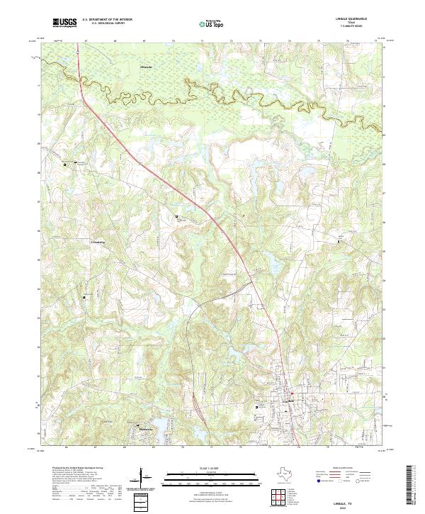
2022 Map of Lindale
USGS Topo · Published 2022About this map
The Sabine River forms the northern boundary of this Smith County landscape, winding through a complex of wetlands and tributaries near Mineola. The southern portion of the map is defined by the growing community of Lindale, where residential developments like Hideaway sit alongside older rural landmarks. Family history is well-preserved across this area through numerous burial sites, including the Flewellen - Thweatt Cem and the Harris Chapel Cem located near Harris Chapel Lake. Water is central to the local geography, with numerous named bodies such as Tomlin Lake, Lindale Club Lake, and Lorraine Lake dotting the terrain. Significant local landmarks like Mt Sinai and the settlement of Friendship provide additional points of orientation for those studying the evolution of East Texas land use and property boundaries.
Find a feature on this map
136 named features on this map. Tap any name to fly to it.
Don’t see what you’re looking for? This feature index may not catch every label — zoom into the map to look around manually.
Map Details
Editions of this 2022 Lindale Map
This is the sole edition of this map. No revisions or reprints were ever made.
Other maps of this area

1948 · Tyler
USGS Topo · 1:62,500

1948 · Brownsboro
USGS Topo · 1:62,500

1949 · Tyler
USGS Topo · 1:62,500

1949 · Brownsboro
USGS Topo · 1:62,500

1956 · Tyler
USGS Topo · 1:250,000

1959 · Golden
USGS Topo · 1:24,000

1959 · Van Lake
USGS Topo · 1:24,000

1959 · Grand Saline
USGS Topo · 1:62,500

1960 · Hainesville
USGS Topo · 1:24,000

1960 · Lindale
USGS Topo · 1:24,000