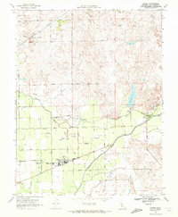
1968 Map of Linden
USGS Topo · Published 1972About this map
Linden serves as the primary hub of this Central Valley landscape, situated at the intersection of a sprawling road network and the Stockton Terminal and Eastern RR. The settlement's local infrastructure is detailed through its High School, Junior High School, and nearby Cemetery. Water management defines the surrounding agricultural terrain, which is intersected by the Calaveras River, Mormon Slough, and Paddy Creek. Notable irrigation and flood control markers include a prominent aqueduct and a dam near Bellota. To the northeast, the terrain becomes more varied near an airway beacon, while the southern reaches follow the path of Mormon Flood Road. The map provides a precise look at rural San Joaquin County as it transitioned during the late 1960s, showing the specific layout of orchards and fields defined by roads like Eightmile Road and Clements Road.
Find a feature on this map
41 named features on this map. Tap any name to fly to it.
Don’t see what you’re looking for? This feature index may not catch every label — zoom into the map to look around manually.
Map Details
Editions of this 1968 Linden Map
3 editions found
Other maps of this area

1889 · Jackson
USGS Topo · 1:125,000

1892 · Jackson
USGS Topo · 1:125,000

1894 · Lodi
USGS Topo · 1:125,000

1897 · Jackson
USGS Topo · 1:125,000

1902 · Jackson
USGS Topo · 1:125,000

1908 · Waterloo
USGS Topo · 1:31,680

1908 · Linden
USGS Topo · 1:31,680

1908 · Lockeford
USGS Topo · 1:31,680

1909 · Clements
USGS Topo · 1:31,680

1914 · Burnham
USGS Topo · 1:31,680