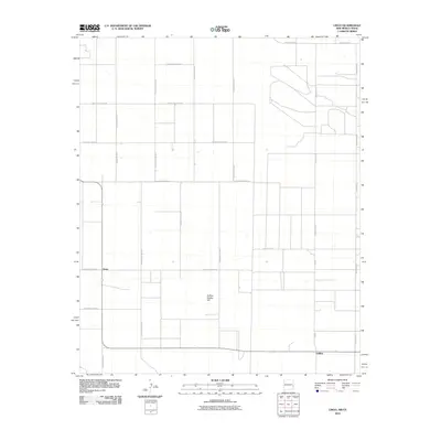
2010 Map of Lingo
USGS Topo · Published 2010About this map
Lingo sits at the intersection of a vast grid of section lines and ranch roads along the New Mexico-Texas border. This 2010 survey by the U.S. Geological Survey illustrates the methodical settlement patterns of Roosevelt County, where long, straight thoroughfares like S Roosevelt Road 32 and S Roosevelt Road D define the landscape. The terrain is largely level, though the presence of Buffalo Soldier Hill provides a singular landmark in an otherwise uniform expanse of agricultural and ranching territory. A network of county and ranch roads, including Ranch Road 54 and Fm 595, facilitates movement across the state line, connecting isolated rural residences and farming plots. The map serves as a clear record of modern land management and road development in the High Plains region.
Find a feature on this map
19 named features on this map. Tap any name to fly to it.
Don’t see what you’re looking for? This feature index may not catch every label — zoom into the map to look around manually.
Map Details
Editions of this 2010 Lingo Map
This is the sole edition of this map. No revisions or reprints were ever made.
Other maps of this area

1954 · Brownfield
USGS Topo · 1:250,000

1958 · Brownfield
USGS Topo · 1:250,000

1962 · Brownfield
USGS Topo · 1:250,000

1968 · Three Way School
USGS Topo · 1:24,000

1969 · Maple
USGS Topo · 1:24,000

1970 · Lingo
USGS Topo · 1:24,000

1970 · Causey East
USGS Topo · 1:24,000

1970 · Morton NW
USGS Topo · 1:24,000

1970 · Bledsoe NE
USGS Topo · 1:24,000

1972 · Bluit
USGS Topo · 1:24,000