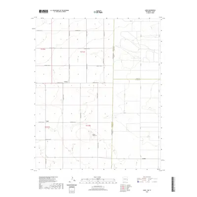
2020 Map of Lingo
USGS Topo · Published 2020About this map
Causey and the small settlement of Lingo anchor this high-plains landscape along the border of Roosevelt County, New Mexico, and the Texas state line. The terrain is characterized by a sparse network of section-line roads, such as S Roosevelt Road 28 and S Roosevelt Road 30, which define the agricultural blocks of the eastern Llano Estacado. A notable topographic exception to the flat horizon is Buffalo Soldier Hill, rising south of Causey. To the southeast, the crossing near Griffith marks the transition into Texas. This survey captures a rural ranching and farming economy where life is organized by the rigid grid of county roads and the proximity to small post office communities that have long served as local hubs for the surrounding homesteads.
Find a feature on this map
29 named features on this map. Tap any name to fly to it.
Don’t see what you’re looking for? This feature index may not catch every label — zoom into the map to look around manually.
Map Details
Editions of this 2020 Lingo Map
This is the sole edition of this map. No revisions or reprints were ever made.
Other maps of this area

1954 · Brownfield
USGS Topo · 1:250,000

1958 · Brownfield
USGS Topo · 1:250,000

1962 · Brownfield
USGS Topo · 1:250,000

1968 · Three Way School
USGS Topo · 1:24,000

1969 · Maple
USGS Topo · 1:24,000

1970 · Lingo
USGS Topo · 1:24,000

1970 · Causey East
USGS Topo · 1:24,000

1970 · Morton NW
USGS Topo · 1:24,000

1970 · Bledsoe NE
USGS Topo · 1:24,000

1972 · Bluit
USGS Topo · 1:24,000