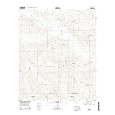
2015 Map of Lisbon
USGS Topo · Published 2015About this map
The Middle Fork Bayou D'Arbonne carves a winding path through the northern reaches of this Louisiana landscape, anchoring a complex drainage network that includes Panther Cr and Sandy Cr. Settled life centers on the village of Lisbon and the smaller community of Sharon to the southeast, where Sharon Cem and Mount Pleasant Cem provide essential touchstones for local genealogical research. The region's infrastructure is defined by a dense web of rural roads, many bearing family names such as Wright Rd, Myra Shirey Ln, and Jess Green Loop. These thoroughfares connect the scattered homesteads and timberlands across the boundary of Claiborne Parish and Lincoln Parish, illustrating a persistent pattern of rural habitation and land use in the Ark-La-Tex region.
Find a feature on this map
59 named features on this map. Tap any name to fly to it.
Don’t see what you’re looking for? This feature index may not catch every label — zoom into the map to look around manually.
Map Details
Editions of this 2015 Lisbon Map
This is the sole edition of this map. No revisions or reprints were ever made.
Other maps of this area

1950 · Ruston
USGS Topo · 1:62,500

1950 · Arcadia
USGS Topo · 1:62,500

1951 · Arcadia
USGS Topo · 1:62,500

1951 · Ruston
USGS Topo · 1:62,500

1951 · Summerfield
USGS Topo · 1:62,500

1951 · Bernice
USGS Topo · 1:62,500

1955 · Shreveport
USGS Topo · 1:250,000

1956 · Shreveport
USGS Topo · 1:250,000

1984 · Shreveport
USGS Topo · 1:250,000

1985 · Monroe North
USGS Topo · 1:100,000