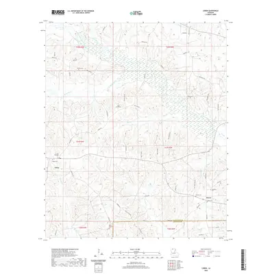
2020 Map of Lisbon
USGS Topo · Published 2020About this map
Lisbon and Sharon anchor this North Louisiana landscape, where the rolling terrain of Claiborne Parish meets the border of Lincoln Parish. This modern record captures a region defined by its dispersed rural settlements and a dense network of local routes such as Walker Evans Rd and Tippett Rd. The hydrology is dominated by the sprawling wetlands and winding course of Middle Fork Bayou D'Arbonne, which gathers numerous tributaries including Fivemile Cr and Sandy Cr. For genealogists, the map is an exceptional resource, meticulously documenting family and community burial grounds like McAdams Cem, Killgore Cem, and the Lisbon Methodist Cem. The distribution of these cemeteries alongside legacy tracks like Friendship Rd reveals the enduring footprint of early parish pioneers within the contemporary landscape.
Find a feature on this map
68 named features on this map. Tap any name to fly to it.
Don’t see what you’re looking for? This feature index may not catch every label — zoom into the map to look around manually.
Map Details
Editions of this 2020 Lisbon Map
This is the sole edition of this map. No revisions or reprints were ever made.
Other maps of this area

1950 · Ruston
USGS Topo · 1:62,500

1950 · Arcadia
USGS Topo · 1:62,500

1951 · Arcadia
USGS Topo · 1:62,500

1951 · Ruston
USGS Topo · 1:62,500

1951 · Summerfield
USGS Topo · 1:62,500

1951 · Bernice
USGS Topo · 1:62,500

1955 · Shreveport
USGS Topo · 1:250,000

1956 · Shreveport
USGS Topo · 1:250,000

1984 · Shreveport
USGS Topo · 1:250,000

1985 · Monroe North
USGS Topo · 1:100,000