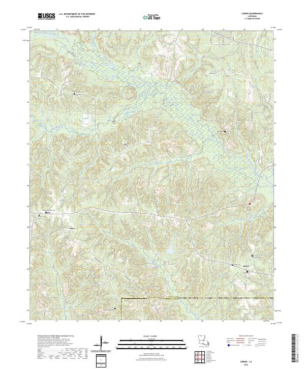
2024 Map of Lisbon
USGS Topo · Published 2024About this map
The community of Lisbon serves as the central point of this modern Louisiana survey, situated within a landscape defined by the winding tributaries of the Middle Fork Bayou D'Arbonne. This portion of Claiborne Parish, extending south into Lincoln Parish, is characterized by its numerous family and community burial grounds, such as the Lisbon Methodist Cem and Killgore Cem. The geography is etched by watercourses including Mulberry Creek and Bear Creek, which have historically dictated the placement of roads and homesteads.
Find a feature on this map
67 named features on this map. Tap any name to fly to it.
Don’t see what you’re looking for? This feature index may not catch every label — zoom into the map to look around manually.
Map Details
Editions of this 2024 Lisbon Map
This is the sole edition of this map. No revisions or reprints were ever made.
Other maps of this area

1950 · Ruston
USGS Topo · 1:62,500

1950 · Arcadia
USGS Topo · 1:62,500

1951 · Arcadia
USGS Topo · 1:62,500

1951 · Ruston
USGS Topo · 1:62,500

1951 · Summerfield
USGS Topo · 1:62,500

1951 · Bernice
USGS Topo · 1:62,500

1955 · Shreveport
USGS Topo · 1:250,000

1956 · Shreveport
USGS Topo · 1:250,000

1984 · Shreveport
USGS Topo · 1:250,000

1985 · Monroe North
USGS Topo · 1:100,000