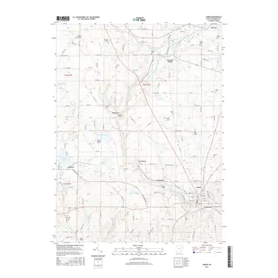
2016 Map of Lisbon
USGS Topo · Published 2016About this map
Lisbon serves as the focal point of this 2016 survey, situated along the Middle Fork Little Beaver Creek in eastern Ohio. The landscape is marked by a complex network of township and county roads that connect outlying settlements such as Franklin Square, Teegarden, and Jordanville. This modern digital survey reveals the enduring rural character of the region, where numerous family and community burial grounds like Salem Township Cem and Saint Jacobs Cem remain preserved among the undulating terrain. Educational institutions including the Kent State Univ Salem Campus and Allegheny Wesleyan Coll anchor the northern reaches near Leetonia. Significant water features such as Guilford Lake and the Salem Reservoir are prominent, while the Salem Waterfront Airport indicates the integration of local aviation into the agricultural and residential landscape of Columbiana County.
Find a feature on this map
115 named features on this map. Tap any name to fly to it.
Don’t see what you’re looking for? This feature index may not catch every label — zoom into the map to look around manually.
Map Details
Editions of this 2016 Lisbon Map
This is the sole edition of this map. No revisions or reprints were ever made.
Other maps of this area

1904 · Wellsville
USGS Topo · 1:62,500

1905 · Salineville
USGS Topo · 1:62,500

1907 · Columbiana
USGS Topo · 1:62,500

1909 · Lisbon
USGS Topo · 1:62,500

1909 · Columbiana
USGS Topo · 1:62,500

1937 · Wellsville
USGS Topo · 1:62,500

1944 · Wellsville
USGS Topo · 1:62,500

1951 · Canton
USGS Topo · 1:250,000

1951 · Columbiana
USGS Topo · 1:24,000

1952 · Damascus
USGS Topo · 1:24,000