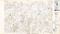
1982 Map of Litchfield
USGS Topo · Published 1982About this map
Crown Mine No 1 and Crown Mine No 2 mark the industrial character of this Central Illinois region, where coal production and agriculture define the landscape. This 1982 map illustrates a dense network of transit and industry, with the Burlington Northern and Illinois Central Gulf railroads connecting established centers like Litchfield, Hillsboro, and Carlinville. The presence of Blackburn College in Carlinville highlights the area's educational roots, while the large reservoirs of Lake Lou Yaeger and Lake Hillsboro indicate the importance of water management for these growing municipalities.
Find a feature on this map
131 named features on this map. Tap any name to fly to it.
Don’t see what you’re looking for? This feature index may not catch every label — zoom into the map to look around manually.
Map Details
Editions of this 1982 Litchfield Map
This is the sole edition of this map. No revisions or reprints were ever made.
Other maps of this area

1912 · Gillespie
USGS Topo · 1:62,500

1915 · Gillespie
USGS Topo · 1:62,500

1915 · Mount Olive
USGS Topo · 1:62,500

1922 · Divernon
USGS Topo · 1:62,500

1923 · Carlinville
USGS Topo · 1:48,000

1923 · Taylorville
USGS Topo · 1:62,500

1923 · Raymond
USGS Topo · 1:62,500

1924 · Divernon
USGS Topo · 1:62,500

1924 · Waverly
USGS Topo · 1:62,500

1925 · Taylorville
USGS Topo · 1:62,500