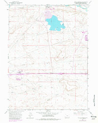
1961 Map of Little America
USGS Topo · Published 1981About this map
Little America and the industrial activity of Westvaco dominate this Sweetwater County landscape during the mid-20th century. The map illustrates a region defined by critical infrastructure, where the Union Pacific railroad and an extensive network of pipelines and an Aqueduct support the local economy. The presence of Westvaco Shaft No 3 and a large Tailings Pond highlights the importance of trona mining and processing in the area.
Find a feature on this map
19 named features on this map. Tap any name to fly to it.
Don’t see what you’re looking for? This feature index may not catch every label — zoom into the map to look around manually.
Map Details
Editions of this 1961 Little America Map
2 editions found
Other maps of this area

1954 · Rock Springs
USGS Topo · 1:250,000

1957 · Mc Kinnon Junction
USGS Topo · 1:62,500

1958 · Rock Springs
USGS Topo · 1:250,000

1961 · Blue Point
USGS Topo · 1:24,000

1961 · Little America
USGS Topo · 1:24,000

1961 · Sevenmile Gulch
USGS Topo · 1:24,000

1961 · Granger
USGS Topo · 1:24,000

1961 · Stevens Flat
USGS Topo · 1:24,000

1961 · Bryan
USGS Topo · 1:24,000

1962 · Rock Springs
USGS Topo · 1:250,000