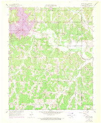
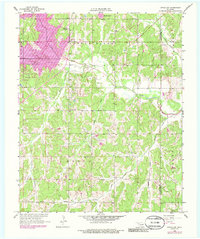
1958 Map of Little Axe
USGS Topo · Published 1970About this map
The Little River flows through this central Oklahoma landscape during a period of significant geographical change, marked by the expansion of Lake Thunderbird in the northwest corner. This 1958 survey, with revisions from 1969, illustrates the intersection of rural community life and the growing petroleum industry. Distinctive cultural markers include the Little Jim Mission and small settlements like Little Axe and Needmore. The map records several legacy sites for local researchers, such as Bethel Cem, Mars Hill Cem, and Bennett Ch. The presence of an Oil Field and scattered Oil Wells highlights the mid-century energy production that shaped the local economy alongside the recreational development of Little River State Park. It captures the transition from traditional homesteads and country churches to the modernized infrastructure of the Oklahoma City metropolitan fringe.
Find a feature on this map
25 named features on this map. Tap any name to fly to it.
Don’t see what you’re looking for? This feature index may not catch every label — zoom into the map to look around manually.
Map Details
Editions of this 1958 Little Axe Map
5 editions found
Other maps of this area

1892 · Moore
USGS Topo · 1:62,500

1893 · Norman
USGS Topo · 1:62,500

1898 · Purcell
USGS Topo · 1:125,000

1910 · McComb
USGS Topo · 1:62,500

1930 · McLoud
USGS Topo · 1:62,500

1934 · Moore
USGS Topo · 1:62,500

1936 · Norman
USGS Topo · 1:62,500

1938 · Moore
USGS Topo · 1:62,500

1954 · Oklahoma City
USGS Topo · 1:250,000
1956 · Franklin
USGS Topo · 1:24,000