
2020 Map of Little Bear Ridge
USGS Topo · Published 2020About this map
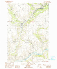
American Ridge and Little Bear Ridge define the elevated landscape of this Nez Perce County region, where agricultural plateaus are sharply divided by deep drainages. The rural character of the area is anchored by small community landmarks, particularly the string of family and local burial grounds including Spencer Cem, Burnt Ridge Cem, and Little Bear Ridge Cem. Water is a central organizing force here, with Big Bear Cr and the W Fork Little Bear Cr carving through the terrain, joined by smaller tributaries like Nora Cr and Dry Cr. The settlement pattern follows these ridges, connected by a network of local routes such as Camps Canyon Rd and Havens Rd. Atwater Lake sits in the eastern portion of the survey, providing a rare standing body of water amidst the system of gulches and canyons like Brady Gulch and Bethel Canyon.
Find a feature on this map
39 named features on this map. Tap any name to fly to it.
Don’t see what you’re looking for? This feature index may not catch every label — zoom into the map to look around manually.
Map Details
Editions of this 2020 Little Bear Ridge Map
This is the sole edition of this map. No revisions or reprints were ever made.
Other maps of this area

1955 · Pullman
USGS Topo · 1:250,000

1958 · Pullman
USGS Topo · 1:250,000

1960 · Troy
USGS Topo · 1:24,000

1960 · Moscow Mtn
USGS Topo · 1:24,000

1960 · Potlatch
USGS Topo · 1:62,500

1961 · Deary
USGS Topo · 1:62,500

1961 · Kendrick
USGS Topo · 1:62,500

1961 · Moscow
USGS Topo · 1:62,500

1981 · Potlatch
USGS Topo · 1:100,000
1990 · Juliaetta
USGS Topo · 1:24,000