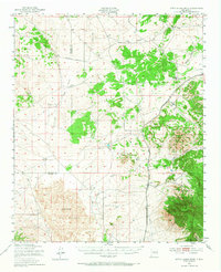
1950 Map of Little Black Peak
USGS Topo · Published 1968About this map
The Malpais dominates the southern landscape of this 1950s study, where ancient Lava flows create a stark contrast against the surrounding high desert. This geological feature is anchored by Little Black Peak and sits just west of the rising Sacramento Mountains. The Southern Pacific railroad corridor serves as the primary artery through the region, connecting the small settlement of Ancho and the siding at Cooper to the broader territory. Local topography is defined by significant drainage systems including Largo Canyon and Coyote Canyon, which cut through the terrain toward the Lincoln National Forest. Historical interest is peaked by the presence of Ruins located near Ancho Valley, suggesting earlier habitation or ranching activity in this arid environment near the Socorro and Lincoln County line.
Find a feature on this map
25 named features on this map. Tap any name to fly to it.
Don’t see what you’re looking for? This feature index may not catch every label — zoom into the map to look around manually.
Map Details
Editions of this 1950 Little Black Peak Map
3 editions found
Other maps of this area

1918 · Oscura Peak
USGS Topo · 1:125,000

1934 · Capitan
USGS Topo · 1:48,000

1937 · Capitan
USGS Topo · 1:62,500

1938 · Carrizozo
USGS Topo · 1:48,000

1943 · Carrizozo
USGS Topo · 1:62,500

1948 · Broken Back Crater
USGS Topo · 1:62,500

1948 · Chihuahua Ranch
USGS Topo · 1:62,500

1950 · Carrizozo
USGS Topo · 1:62,500

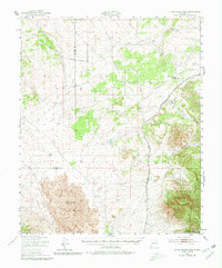
1950 · Little Black Peak
USGS Topo · 1:62,500

1954 · Tularosa
USGS Topo · 1:250,000