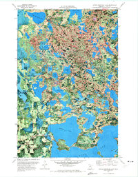
1970 Map of Little Bowstring Lake
USGS Topo · Published 1973About this map
The settlement of Suomi sits at the edge of a complex glacial landscape within the Chippewa National Forest and Bowstring State Forest. In 1970, this area of Itasca County was defined by its dense concentration of water bodies, including Little Bowstring Lake, Suomi Lake, and Little Moose Lake. An Old Railroad Grade cuts through the western section of the map, serving as a reminder of the region's logging history and the infrastructure required to move timber through this lake-rich terrain. Along the southern edge, the expansive northern waters of Deer Lake dominate the frame.
Find a feature on this map
58 named features on this map. Tap any name to fly to it.
Don’t see what you’re looking for? This feature index may not catch every label — zoom into the map to look around manually.
Map Details
Editions of this 1970 Little Bowstring Lake Map
2 editions found
Other maps of this area

1919 · Marcell
USGS Topo · 1:62,500

1953 · Cohasset East
USGS Topo · 1:24,000

1953 · Cohasset West
USGS Topo · 1:24,000

1954 · Hibbing
USGS Topo · 1:250,000

1957 · Hibbing
USGS Topo · 1:250,000

1958 · Hibbing
USGS Topo · 1:250,000

1964 · Hibbing
USGS Topo · 1:250,000

1970 · Deer River NE
USGS Topo · 1:24,000

1970 · Wabana Lake
USGS Topo · 1:24,000

1970 · Clubhouse Lake
USGS Topo · 1:24,000