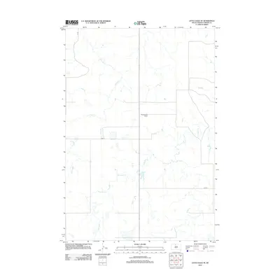
2012 Map of Little Eagle SE
USGS Topo · Published 2012About this map
Runaround Butte rises as a prominent landmark in this section of Corson County, anchoring a landscape defined by seasonal drainages and local prairie routes. The drainage patterns of Little Oak Cr and Deep Bank Cr reveal the natural flow of water toward the Standing Rock Reservation's heart, illustrating the subtle topography of the Great Plains. Though the area is sparsely settled, the presence of Co Rd-16 and Co Rd-20 indicates the essential grid of rural infrastructure that supports the region's agricultural and ranching operations. The detailed charting of these creeks and county roads provides a spatial understanding of this specific prairie environment in the early twenty-first century.
Find a feature on this map
6 named features on this map. Tap any name to fly to it.
Don’t see what you’re looking for? This feature index may not catch every label — zoom into the map to look around manually.
Map Details
Editions of this 2012 Little Eagle SE Map
This is the sole edition of this map. No revisions or reprints were ever made.
Other maps of this area

1953 · McIntosh
USGS Topo · 1:250,000

1956 · Little Eagle SW
USGS Topo · 1:24,000

1956 · Wakpala NW
USGS Topo · 1:24,000

1956 · Little Eagle
USGS Topo · 1:24,000

1956 · Little Eagle SE
USGS Topo · 1:24,000

1956 · Little Eagle NW
USGS Topo · 1:24,000

1956 · Wakpala SW
USGS Topo · 1:24,000

1958 · McIntosh
USGS Topo · 1:250,000

1975 · Glencross
USGS Topo · 1:24,000

1975 · Trail City
USGS Topo · 1:24,000