
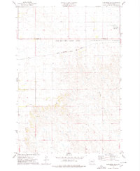
1956 Map of Little Eagle SE
USGS Topo · Published 1957About this map
Runaround Butte rises above a landscape defined by the winding paths of Little Oak Creek and Deep Bank Creek in this mid-century survey. The distribution of rural landmarks across these prairie sections reflects a sparse but organized settlement pattern typical of the Missouri River Basin's development era. Of particular interest to genealogists and local historians are the three distinct school sites recorded during this period, including the Harding Sch (Abandoned), Reinbold Sch, and Fisher Sch. These locations serve as crucial markers for documenting the social fabric and community centers of Corson County during the 1950s. The map illustrates the transition of early educational infrastructure, explicitly noting where facilities like the Harding School had already fallen out of use by the time of the 1956 field check.
Find a feature on this map
8 named features on this map. Tap any name to fly to it.
Don’t see what you’re looking for? This feature index may not catch every label — zoom into the map to look around manually.
Map Details
Editions of this 1956 Little Eagle SE Map
This is the sole edition of this map. No revisions or reprints were ever made.
Other maps of this area

1953 · McIntosh
USGS Topo · 1:250,000

1956 · Little Eagle SW
USGS Topo · 1:24,000

1956 · Wakpala NW
USGS Topo · 1:24,000

1956 · Little Eagle
USGS Topo · 1:24,000

1956 · Little Eagle NW
USGS Topo · 1:24,000

1956 · Wakpala SW
USGS Topo · 1:24,000

1958 · McIntosh
USGS Topo · 1:250,000

1975 · Glencross
USGS Topo · 1:24,000

1975 · Trail City
USGS Topo · 1:24,000
1975 · Glencross NE
USGS Topo · 1:24,000