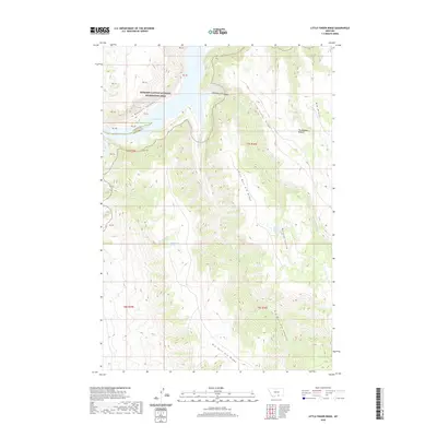
2020 Map of Little Finger Ridge
USGS Topo · Published 2020About this map
Bighorn Canyon National Recreation Area dominates this landscape along the border of Carbon and Big Horn counties. The topography is defined by a series of prominent high points, including Little Finger Ridge, Little Bull Elk Ridge, and Big Bull Elk Ridge, which create a complex network of drainage systems. At the heart of the terrain, Bighorn Lake fills the depths of Bighorn Canyon, a significant hydrological feature fed by numerous drainages such as Big Bull Elk Creek and Little Bull Elk Creek.
Find a feature on this map
17 named features on this map. Tap any name to fly to it.
Don’t see what you’re looking for? This feature index may not catch every label — zoom into the map to look around manually.
Map Details
Editions of this 2020 Little Finger Ridge Map
This is the sole edition of this map. No revisions or reprints were ever made.
Other maps of this area

1894 · St. Xavier
USGS Topo · 1:125,000

1901 · St. Xavier
USGS Topo · 1:125,000

1954 · Billings
USGS Topo · 1:250,000

1954 · Hardin
USGS Topo · 1:250,000

1957 · Hardin
USGS Topo · 1:250,000

1957 · Billings
USGS Topo · 1:250,000

1958 · Billings
USGS Topo · 1:250,000

1958 · Hardin
USGS Topo · 1:250,000

1964 · Two Point
USGS Topo · 1:24,000

1964 · Peyote Point
USGS Topo · 1:24,000