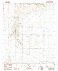
1988 Map of Little Mule Mountains
USGS Topo · Published 1988About this map
The Little Mule Mountains dominate this arid landscape within Imperial County, serving as a prominent north-south ridge that defines the local topography. This 1988 survey illustrates a region largely characterized by wide desert washes and rugged upland terrain, where Milpitas Wash and Arroyo Seco carve through the sedimentary floor. The eastern half of the map opens into the broad Smoketree Valley, while the southern reaches are marked by the presence of the Aerial Gunnery Range, indicating the area's role in military training operations during the late 20th century.
Find a feature on this map
11 named features on this map. Tap any name to fly to it.
Don’t see what you’re looking for? This feature index may not catch every label — zoom into the map to look around manually.
Map Details
Editions of this 1988 Little Mule Mountains Map
2 editions found
Other maps of this area

1942 · Blythe
USGS Topo · 1:250,000

1953 · Palo Verde Mountains
USGS Topo · 1:62,500

1953 · Quartz Peak
USGS Topo · 1:62,500

1953 · Chuckwalla Spring
USGS Topo · 1:62,500

1953 · Acolita
USGS Topo · 1:62,500

1954 · Salton Sea
USGS Topo · 1:250,000

1955 · Salton Sea
USGS Topo · 1:250,000

1959 · Salton Sea
USGS Topo · 1:250,000

1963 · Salton Sea
USGS Topo · 1:250,000

1965 · Salton Sea
USGS Topo · 1:250,000