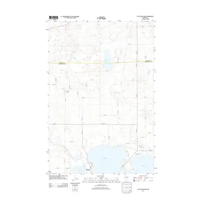
2013 Map of Little Pine Lake
USGS Topo · Published 2013About this map
The settlement of Perham sits at the southern edge of this landscape where the Otter Tail River connects the local basin. The area is defined by its post-glacial hydrology, with the massive Little Pine Lake and Big Pine Lake dominating the southern half of the quadrangle. A network of smaller water bodies, including Stein Lake, Dead Lake, and Indian Lake, are scattered across the terrain, linked by waterways like the Toad River and Collett Cr.
Find a feature on this map
47 named features on this map. Tap any name to fly to it.
Don’t see what you’re looking for? This feature index may not catch every label — zoom into the map to look around manually.
Map Details
Editions of this 2013 Little Pine Lake Map
This is the sole edition of this map. No revisions or reprints were ever made.
Other maps of this area

1915 · Perham
USGS Topo · 1:62,500

1953 · Brainerd
USGS Topo · 1:250,000

1957 · Brainerd
USGS Topo · 1:250,000

1958 · Brainerd
USGS Topo · 1:250,000

1959 · Toad Mountain
USGS Topo · 1:24,000

1959 · Rochert
USGS Topo · 1:24,000

1965 · Brainerd
USGS Topo · 1:250,000

1969 · Evergreen
USGS Topo · 1:24,000

1969 · New York Mills NW
USGS Topo · 1:24,000

1969 · New York Mills West
USGS Topo · 1:24,000