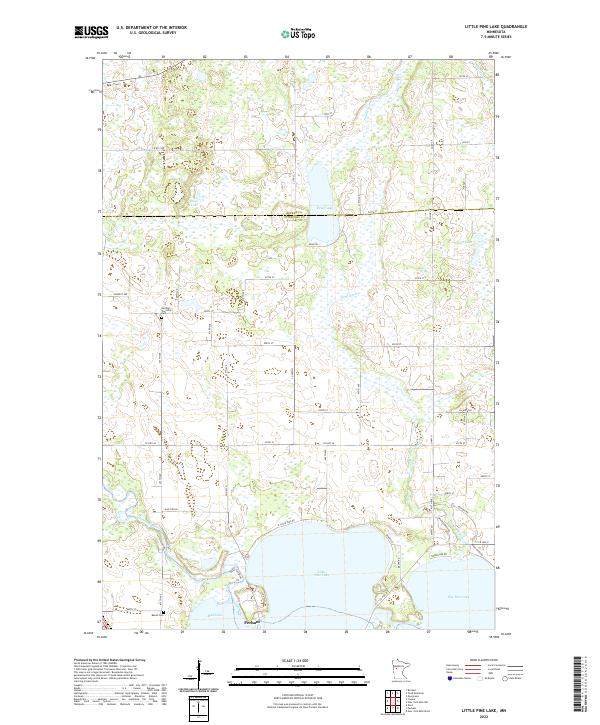
2022 Map of Little Pine Lake
USGS Topo · Published 2022About this map
The Otter Tail River and Toad River converge into a landscape defined by expansive water bodies and glacial wetlands along the border of Becker and Otter Tail counties. This 2022 survey captures the northern outskirts of Perham, where the terrain transitions from the open waters of Little Pine Lake and Big Pine Lake to the more secluded Mud Lake and Stein Lake. The map reveals a rural geography shaped by township divisions, with the Gorman Township Cem and Bauck Cem serving as quiet markers of the area's pioneer heritage. A network of county roads, including Co Hwy 60 and Co Rd 51, provides access to the shoreline developments and agricultural tracts that characterize this lake-rich region. The intricate drainage of Collett Cr and the marshlands surrounding Dead Lake emphasize the complex hydrology inherent to this part of Minnesota's vacation and farming country.
Find a feature on this map
41 named features on this map. Tap any name to fly to it.
Don’t see what you’re looking for? This feature index may not catch every label — zoom into the map to look around manually.
Map Details
Editions of this 2022 Little Pine Lake Map
This is the sole edition of this map. No revisions or reprints were ever made.
Other maps of this area

1915 · Perham
USGS Topo · 1:62,500

1953 · Brainerd
USGS Topo · 1:250,000

1957 · Brainerd
USGS Topo · 1:250,000

1958 · Brainerd
USGS Topo · 1:250,000

1959 · Toad Mountain
USGS Topo · 1:24,000

1959 · Rochert
USGS Topo · 1:24,000

1965 · Brainerd
USGS Topo · 1:250,000

1969 · Evergreen
USGS Topo · 1:24,000

1969 · New York Mills NW
USGS Topo · 1:24,000

1969 · New York Mills West
USGS Topo · 1:24,000