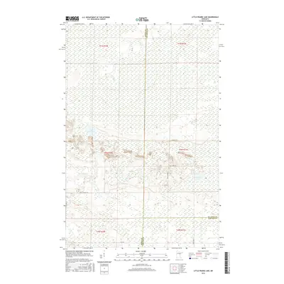
2016 Map of Little Prairie Lake
USGS Topo · Published 2016About this map
Little Prairie Lake sits at the heart of this northern Minnesota wetland landscape, where the headwaters of the Prairie River and E Savanna River wind through a complex terrain of marsh and glacial deposits. This 2016 survey captures the tri-county corner where Aitkin Co meets St. Louis Co and Carlton Co, a boundary point that defines the local jurisdictional history. The area is characterized by its hydrological network, including Roosevelt Lake and several unnamed water bodies scattered across the township lines. A sparse network of local thoroughfares like Bear Lodge Rd and Basalm Forrest Rd provides access to these remote tracts, illustrating the modern management of these wooded and swampy lowlands.
Find a feature on this map
20 named features on this map. Tap any name to fly to it.
Don’t see what you’re looking for? This feature index may not catch every label — zoom into the map to look around manually.
Map Details
Editions of this 2016 Little Prairie Lake Map
This is the sole edition of this map. No revisions or reprints were ever made.
Other maps of this area

1953 · Duluth
USGS Topo · 1:250,000

1958 · Duluth
USGS Topo · 1:250,000

1961 · Cromwell
USGS Topo · 1:62,500

1963 · Prairie Lake
USGS Topo · 1:24,000
1963 · Floodwood
USGS Topo · 1:24,000

1969 · Island
USGS Topo · 1:24,000

1970 · Tamarack
USGS Topo · 1:24,000

1970 · Little Prairie Lake
USGS Topo · 1:24,000
1970 · Vanduse Lake
USGS Topo · 1:24,000

1970 · Balsam
USGS Topo · 1:24,000