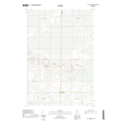
2019 Map of Little Prairie Lake
USGS Topo · Published 2019About this map
Little Prairie Lake and the winding Prairie River anchor this 2019 survey of the marshy interior where Aitkin, St. Louis, and Carlton counties meet. The landscape is defined by vast wetland complexes and slow-moving water, including the E Savanna River and Roosevelt Lake. This is a terrain of low relief, dominated by the hydrology of the northern woods and a sparse network of local roads.
Find a feature on this map
19 named features on this map. Tap any name to fly to it.
Don’t see what you’re looking for? This feature index may not catch every label — zoom into the map to look around manually.
Map Details
Editions of this 2019 Little Prairie Lake Map
This is the sole edition of this map. No revisions or reprints were ever made.
Other maps of this area

1953 · Duluth
USGS Topo · 1:250,000

1958 · Duluth
USGS Topo · 1:250,000

1961 · Cromwell
USGS Topo · 1:62,500

1963 · Prairie Lake
USGS Topo · 1:24,000
1963 · Floodwood
USGS Topo · 1:24,000

1969 · Island
USGS Topo · 1:24,000

1970 · Tamarack
USGS Topo · 1:24,000

1970 · Little Prairie Lake
USGS Topo · 1:24,000
1970 · Vanduse Lake
USGS Topo · 1:24,000

1970 · Balsam
USGS Topo · 1:24,000