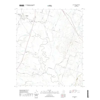
2019 Map of Little River
USGS Topo · Published 2019About this map
Little River-Academy is defined by the winding course of the Little River, which carves a deep, serpentine path through central Bell County. The dual settlements of Little River and Academy anchor the northern landscape, while the community of Sparks sits to the southwest. This area preserves a high density of small family and community burial grounds, including the Little River Cem, Volo Cem, and Sunshine Cem, reflecting the deep roots of agricultural families in the region. The topography rises toward Knob Hill in the east, overlooking a network of seasonal waterways like Runnells Cr and Georgia Br. Near the eastern boundary, specialized water features such as Lansham Lake and Prewitt Lake 5 suggest the importance of managed water resources for the local landscape. The map also captures the transition from Bell County into Milam County along its southern edge near the Little River.
Find a feature on this map
74 named features on this map. Tap any name to fly to it.
Don’t see what you’re looking for? This feature index may not catch every label — zoom into the map to look around manually.
Map Details
Editions of this 2019 Little River Map
This is the sole edition of this map. No revisions or reprints were ever made.
Other maps of this area

1885 · Taylor
USGS Topo · 1:125,000

1887 · Taylor
USGS Topo · 1:125,000

1892 · Temple
USGS Topo · 1:125,000

1894 · Taylor
USGS Topo · 1:125,000

1910 · Buckholts
USGS Topo · 1:24,000

1912 · Buckholts
USGS Topo · 1:31,680

1924 · Temple 3-C
USGS Topo · 1:48,000

1931 · Belton
USGS Topo · 1:62,500

1954 · Waco
USGS Topo · 1:250,000

1954 · Austin
USGS Topo · 1:250,000
Featured Places
- Little River-Academy, TX
- Sparks, TX
- Joe Lee, TX
- Little River, Little River-Academy
- Academy, Little River-Academy