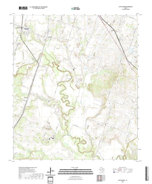
2022 Map of Little River
USGS Topo · Published 2022About this map
Little River-Academy and the adjacent community of Academy anchor the northern landscape of this Bell County quadrangle. The terrain is defined by the winding course of the Little River, which meanders through the central and southern portions of the map, joined by numerous tributaries including Knob Cr and Georgia Br. This rural Texas landscape is marked by a high density of small family and community burial grounds, such as the Little River-Wilson Valley Cem, Reed Family Cem, and Volo Cem, which offer significant value for genealogical research. The settlement of Sparks sits to the west, while the eastern reaches feature localized water bodies like Lansham Lake and Prewitt Lake 5. The road network, including FM 436, connects these dispersed settlements and agricultural tracts, revealing the long-standing land divisions and drainage patterns along the river valley.
Find a feature on this map
75 named features on this map. Tap any name to fly to it.
Don’t see what you’re looking for? This feature index may not catch every label — zoom into the map to look around manually.
Map Details
Editions of this 2022 Little River Map
This is the sole edition of this map. No revisions or reprints were ever made.
Other maps of this area

1885 · Taylor
USGS Topo · 1:125,000

1887 · Taylor
USGS Topo · 1:125,000

1892 · Temple
USGS Topo · 1:125,000

1894 · Taylor
USGS Topo · 1:125,000

1910 · Buckholts
USGS Topo · 1:24,000

1912 · Buckholts
USGS Topo · 1:31,680

1924 · Temple 3-C
USGS Topo · 1:48,000

1931 · Belton
USGS Topo · 1:62,500

1954 · Waco
USGS Topo · 1:250,000

1954 · Austin
USGS Topo · 1:250,000
Featured Places
- Little River-Academy, TX
- Sparks, TX
- Joe Lee, TX
- Academy, Little River-Academy
- Little River, Little River-Academy