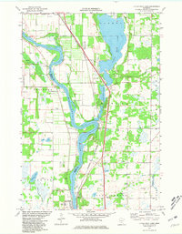
1974 Map of Little Rock Lake
USGS Topo · Published 1981About this map
The Mississippi River creates a meandering border between Stearns Co and Benton Co in this mid-1970s survey. The landscape is defined by the significant expanse of Little Rock Lake to the north and a series of extractive industrial sites, including numerous Gravel Pits and a Quarry near Watab. This era shows the developed southern portion of the region around Sartell, where a High Sch and the Radio Tower (WWJO) stand as local landmarks.
Find a feature on this map
33 named features on this map. Tap any name to fly to it.
Don’t see what you’re looking for? This feature index may not catch every label — zoom into the map to look around manually.
Map Details
Editions of this 1974 Little Rock Lake Map
3 editions found
Other maps of this area

1948 · Pierz
USGS Topo · 1:62,500

1948 · Little Falls
USGS Topo · 1:62,500

1950 · Little Falls
USGS Topo · 1:62,500

1950 · Pierz
USGS Topo · 1:62,500

1950 · St. Cloud
USGS Topo · 1:62,500

1953 · Saint Cloud
USGS Topo · 1:250,000

1957 · Saint Cloud
USGS Topo · 1:250,000

1958 · Saint Cloud
USGS Topo · 1:250,000

1965 · St Stephen
USGS Topo · 1:24,000

1965 · St Joseph
USGS Topo · 1:24,000