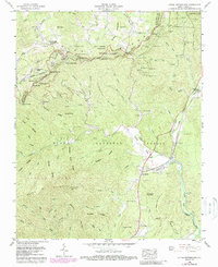
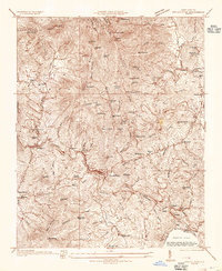
1960 Map of Little Switzerland
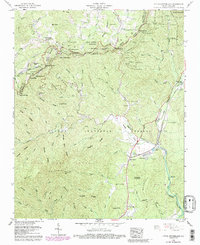
USGS Topo · Published 1988About this map
The Little Switzerland resort area straddles the boundary between Mitchell Co and McDowell Co, defined by the winding course of the Blue Ridge Parkway along the crest. This map reveals a complex vertical landscape where the mountain tourism of the heights meets the industrial and agricultural reality of the valleys. To the east, the Clinchfield railroad threads through a series of tunnels below Swafford Gap, while the North Fork Catawba River carves through the southern terrain toward Woodlawn. Local genealogy is anchored by numerous small landmarks like Chestnut Grove Ch and the Collis Cem near Laurel Lake. The transition from the Pisgah National Forest to the Pisgah Game Lands illustrates the region's mid-century management as a protected mountain landscape.
Find a feature on this map
52 named features on this map. Tap any name to fly to it.
Don’t see what you’re looking for? This feature index may not catch every label — zoom into the map to look around manually.
Map Details
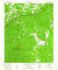
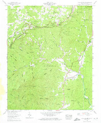
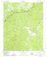
Editions of this 1960 Little Switzerland Map
5 editions found
Other maps of this area

1900 · Mount Mitchell
USGS Topo · 1:125,000

1902 · Mount Mitchell
USGS Topo · 1:125,000

1905 · Morganton
USGS Topo · 1:125,000

1934 · Micaville
USGS Topo · 1:24,000
1934 · Spruce Pine
USGS Topo · 1:24,000

1934 · Parts Of Celo And Black Brothers
USGS Topo · 1:24,000

1934 · Parts Of Old Fort and Montreat
USGS Topo · 1:24,000

1934 · Linville Falls
USGS Topo · 1:24,000

1953 · Charlotte
USGS Topo · 1:250,000

1954 · Charlotte
USGS Topo · 1:250,000