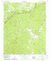
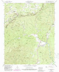
1960 Map of Little Switzerland
USGS Topo · Published 1979About this map
Little Switzerland and the surrounding Blue Ridge heights are defined by a complex transportation network that winds through the Pisgah National Forest. The Clinchfield railroad dominates the eastern slopes, utilizing an intricate system of tunnels such as the Little Switzerland Tunnel and Bird Ridge Tunnel to navigate the steep descent toward the North Fork Catawba River. This engineering feat includes The Loop, a distinctive spiral necessary for managing the grade.
Find a feature on this map
115 named features on this map. Tap any name to fly to it.
Don’t see what you’re looking for? This feature index may not catch every label — zoom into the map to look around manually.
Map Details
Editions of this 1960 Little Switzerland Map
5 editions found
Other maps of this area

1900 · Mount Mitchell
USGS Topo · 1:125,000

1902 · Mount Mitchell
USGS Topo · 1:125,000

1905 · Morganton
USGS Topo · 1:125,000

1934 · Micaville
USGS Topo · 1:24,000

1934 · Spruce Pine
USGS Topo · 1:24,000

1934 · Parts Of Celo And Black Brothers
USGS Topo · 1:24,000

1934 · Parts Of Old Fort and Montreat
USGS Topo · 1:24,000

1934 · Linville Falls
USGS Topo · 1:24,000

1953 · Charlotte
USGS Topo · 1:250,000

1954 · Charlotte
USGS Topo · 1:250,000