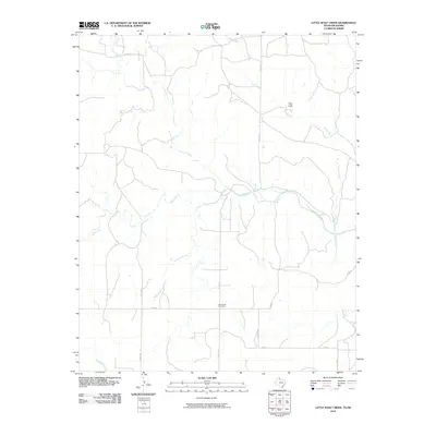
2010 Map of Little Wolf Creek
USGS Topo · Published 2010About this map
Needwood Cemetery and a network of rural county roads anchor this 2010 landscape in Beckham County. The terrain is defined by a dense web of ephemeral and perennial drainage systems, including the namesake Little Wolf Creek and the more prominent Wolf Creek. These waterways, alongside others like Elm Creek and Lost Creek, indicate a landscape shaped by significant alluvial action, typical of the plains transition zones. Settlement patterns here are sparse, with Lost Creek Ranch serving as a notable landmark among the sprawling agricultural and grazing lands. The layout of the roads, such as Co RD 270 and FM 1438, follows the classic grid of the Public Land Survey System, providing essential access to remote ranching outposts and family burial grounds in a region where the creek beds dictate the local geography.
Find a feature on this map
18 named features on this map. Tap any name to fly to it.
Don’t see what you’re looking for? This feature index may not catch every label — zoom into the map to look around manually.
Map Details
Editions of this 2010 Little Wolf Creek Map
This is the sole edition of this map. No revisions or reprints were ever made.
Other maps of this area

1954 · Amarillo
USGS Topo · 1:250,000

1954 · Plainview
USGS Topo · 1:250,000

1955 · Lawton
USGS Topo · 1:250,000

1955 · Clinton
USGS Topo · 1:250,000

1957 · Clinton
USGS Topo · 1:250,000

1958 · Amarillo
USGS Topo · 1:250,000

1958 · Plainview
USGS Topo · 1:250,000

1959 · Wellington NW
USGS Topo · 1:24,000

1959 · Shinnery Creek
USGS Topo · 1:24,000

1961 · Erick
USGS Topo · 1:62,500