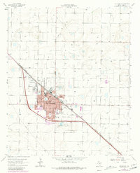
1964 Map of Littlefield
USGS Topo · Published 1981About this map
The agricultural and energy landscape of the Texas Panhandle centers on Littlefield, where the Atchison Topeka and Santa Fe railroad cuts diagonally through a grid of section lines and irrigation wells. Surveyed in the early 1960s with updates through 1979, the map illustrates a town undergoing mid-century development, evidenced by the established residential core around Laguna Park and the appearance of a Drive-in Theater and Trailer Park on the outskirts.
Find a feature on this map
26 named features on this map. Tap any name to fly to it.
Don’t see what you’re looking for? This feature index may not catch every label — zoom into the map to look around manually.
Map Details
Editions of this 1964 Littlefield Map
2 editions found

Other maps of this area

1954 · Clovis
USGS Topo · 1:250,000

1954 · Brownfield
USGS Topo · 1:250,000

1957 · Anton
USGS Topo · 1:62,500

1958 · Brownfield
USGS Topo · 1:250,000

1958 · Clovis
USGS Topo · 1:250,000

1962 · Brownfield
USGS Topo · 1:250,000

1962 · Amherst
USGS Topo · 1:24,000

1962 · Cofferville
USGS Topo · 1:24,000

1962 · Fieldton
USGS Topo · 1:24,000

1964 · Oklahoma Flat
USGS Topo · 1:24,000