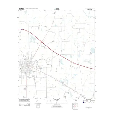
2012 Map of Live Oak East
USGS Topo · Published 2012About this map
Live Oak serves as the focal point of this 2012 survey, revealing the grid-like expansion of Suwannee County's seat toward the northeast. This landscape is defined by its transition from a structured urban center to a rural mosaic of prairies and wetlands. Notable local identifiers include Horse Prairie and the evocative Little Hell Lake, which punctuate the low-lying terrain. To the north, the winding Suwannee River flows near its confluence with Camp Br, anchoring the regional hydrology. Transport and agricultural patterns are evident in the corridors connecting Rixford and Houston, while unique landmarks like The Old Bulb Farm and the Wings n Sunsets LLC Airport provide specific points of interest for local historians. The map also highlights smaller family-named locales such as Randys Ranch and the community of Slade, reflecting the area's continued reliance on land-based industry and aviation.
Find a feature on this map
89 named features on this map. Tap any name to fly to it.
Don’t see what you’re looking for? This feature index may not catch every label — zoom into the map to look around manually.
Map Details
Editions of this 2012 Live Oak East Map
This is the sole edition of this map. No revisions or reprints were ever made.
Other maps of this area

1954 · Valdosta
USGS Topo · 1:250,000

1955 · Mayo NE
USGS Topo · 1:24,000

1958 · Valdosta
USGS Topo · 1:250,000

1958 · Fort Union
USGS Topo · 1:24,000

1959 · Valdosta
USGS Topo · 1:250,000

1959 · Live Oak West
USGS Topo · 1:24,000

1961 · Live Oak East
USGS Topo · 1:24,000

1961 · Hillcoat
USGS Topo · 1:24,000

1961 · White Springs West
USGS Topo · 1:24,000

1962 · Genoa
USGS Topo · 1:24,000