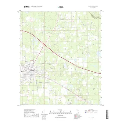
2018 Map of Live Oak East
USGS Topo · Published 2018About this map
The Live Oak city center and its eastern periphery dominate this Suwannee County landscape, where the street grid of the county seat gives way to a complex network of wetlands and small lakes. Settlement patterns follow the historic transportation corridors, including neighborhoods around Slade and Rixford, and the smaller community of Houston to the southeast. The natural geography is defined by numerous depressions and water bodies typical of the Florida karst landscape, such as Hare Lake, Little Hell Lake, and the wetland expanse of Horse Prairie. In the northeastern corner, the Suwannee River forms the border with Hamilton County, its course accompanied by the Florida National Scenic Trail. Industry and transportation are represented by the crossing of major rail lines near Railroad Ave SE and the presence of the Wings n Sunsets LLC Airport, which highlights the area's continued role as a regional transit hub.
Find a feature on this map
95 named features on this map. Tap any name to fly to it.
Don’t see what you’re looking for? This feature index may not catch every label — zoom into the map to look around manually.
Map Details
Editions of this 2018 Live Oak East Map
This is the sole edition of this map. No revisions or reprints were ever made.
Other maps of this area

1954 · Valdosta
USGS Topo · 1:250,000

1955 · Mayo NE
USGS Topo · 1:24,000

1958 · Valdosta
USGS Topo · 1:250,000

1958 · Fort Union
USGS Topo · 1:24,000

1959 · Valdosta
USGS Topo · 1:250,000

1959 · Live Oak West
USGS Topo · 1:24,000

1961 · Live Oak East
USGS Topo · 1:24,000

1961 · Hillcoat
USGS Topo · 1:24,000

1961 · White Springs West
USGS Topo · 1:24,000

1962 · Genoa
USGS Topo · 1:24,000