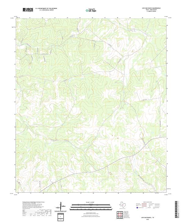
2022 Map of Live Oak Ranch
USGS Topo · Published 2022About this map
Bear Cr carves through the undulating terrain of this Kerr County landscape, providing a primary drainage for a network of ranch roads and remote homesteads. The area is defined by large-scale ranching properties, evidenced by naming conventions for thoroughfares such as Henry Prigur Ranch Rd W and Ponda Rosa Ranch Rd. This 2022 survey illustrates the modern division of Hill Country land, where traditional agricultural routes like Hyatt Mill Rd and Black Bull Rd intersect with newer residential and access trails. The presence of E Camino Real Rd suggests a historical continuity in the travel corridors of the region, even as the landscape transitions into contemporary ranching and recreational use. The intersection of FM 1340 serves as a modern waypoint in this sparsely populated portion of Texas, connecting these interior ranchlands to the broader state road network.
Find a feature on this map
24 named features on this map. Tap any name to fly to it.
Don’t see what you’re looking for? This feature index may not catch every label — zoom into the map to look around manually.
Map Details
Editions of this 2022 Live Oak Ranch Map
This is the sole edition of this map. No revisions or reprints were ever made.
Other maps of this area

1894 · Kerrville
USGS Topo · 1:125,000

1954 · Llano
USGS Topo · 1:250,000

1955 · Llano
USGS Topo · 1:250,000

1956 · Llano
USGS Topo · 1:250,000

1963 · Garven Store
USGS Topo · 1:24,000

1963 · Y O Ranch
USGS Topo · 1:24,000

1964 · Boneyard Draw
USGS Topo · 1:24,000
1964 · Contrary Creek
USGS Topo · 1:24,000
1964 · Bee Caves Creek
USGS Topo · 1:24,000

1964 · Live Oak Ranch
USGS Topo · 1:24,000