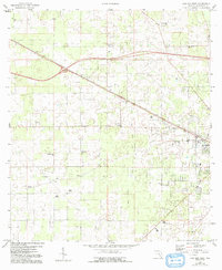
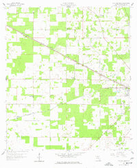
1959 Map of Live Oak West
USGS Topo · Published 1993About this map
The town of Live Oak serves as the eastern anchor of this North Florida landscape, where the transition from agricultural fields to piney flatlands is marked by a network of rural settlements. Small communities such as Marybelle and Dickert align with the railroad and roadway corridors, showing the inland Suwannee County settlement patterns of the mid-20th century. Cultural life is deeply rooted in the area's numerous country churches, including Delaware Ch, Mt Olive Ch, and Rock Cut Ch. The presence of the Agricultural Coliseum and the Armory on the edge of the county seat highlights the region's historical reliance on farming and local governance. Further west, the landscape is punctuated by family and community landmarks like Starr, Mercer, and the Rock Cut Cem, providing a detailed record of the families who inhabited these woods and clearings before late-century growth reached the area.
Find a feature on this map
21 named features on this map. Tap any name to fly to it.
Don’t see what you’re looking for? This feature index may not catch every label — zoom into the map to look around manually.
Map Details
Editions of this 1959 Live Oak West Map
3 editions found
Other maps of this area

1954 · Dowling Park
USGS Topo · 1:24,000

1954 · Valdosta
USGS Topo · 1:250,000

1955 · Mayo NE
USGS Topo · 1:24,000

1958 · Valdosta
USGS Topo · 1:250,000

1958 · Fort Union
USGS Topo · 1:24,000

1959 · Valdosta
USGS Topo · 1:250,000

1959 · Ellaville
USGS Topo · 1:24,000

1959 · Live Oak West
USGS Topo · 1:24,000

1959 · Falmouth
USGS Topo · 1:24,000

1961 · Live Oak East
USGS Topo · 1:24,000