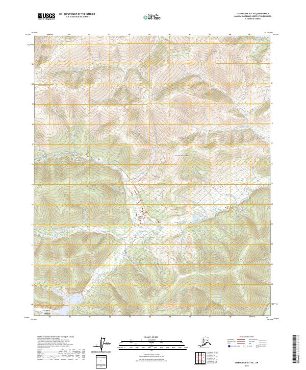
2024 Map of Livengood A-1 SE
USGS Topo · Published 2024About this map
Coffee Dome and Fourth of July Hill anchor this upland landscape northeast of Fairbanks, where the terrain is carved by a dense network of gold-rush era drainages. The map reveals a land defined by its mining heritage, evidenced by evocative watercourse names such as Sixteen-to-one Creek, All Gold Creek, and Too Much Gold Creek. Transportation through these interior ridges is primarily facilitated by Fairbanks Creek Road, which follows the contours of the valley floor along Fairbanks Creek. This modern survey provides a detailed view of the Steele Creek area, showing the current state of land use and access in a region historically dominated by placer mining and seasonal exploration. Small drainages like Dream Gulch and Snow Gulch further illustrate the fine-grained topographic detail of the Fairbanks North Star Borough's interior hills.
Find a feature on this map
36 named features on this map. Tap any name to fly to it.
Don’t see what you’re looking for? This feature index may not catch every label — zoom into the map to look around manually.
Map Details
Editions of this 2024 Livengood A-1 SE Map
This is the sole edition of this map. No revisions or reprints were ever made.
Other maps of this area

1945 · Livengood
USGS Topo · 1:250,000

1949 · Fairbanks D-1
USGS Topo · 1:62,500

1950 · Fairbanks
USGS Topo · 1:250,000

1950 · Big Delta
USGS Topo · 1:250,000

1950 · Big Delta D-6
USGS Topo · 1:63,360

1951 · Big Delta
USGS Topo · 1:250,000

1951 · Fairbanks
USGS Topo · 1:250,000

1951 · Livengood
USGS Topo · 1:250,000

1951 · Circle
USGS Topo · 1:250,000

1952 · Big Delta D-6
USGS Topo · 1:63,360