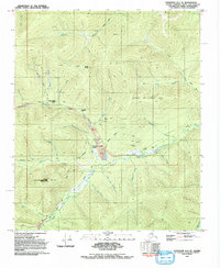
1992 Map of Livengood A-1 SE
USGS Topo · Published 1992About this map
Gold mining operations and remote research installations dominate this subarctic landscape north of the Chena River in the early 1990s. The drainage of Fairbanks Creek is heavily marked by industrial activity, showing numerous tailings piles, prospect pits, and established bases such as Fairbanks Creek Camp and Alder Creek Camp. Higher elevations like Coffee Dome and Fourth Of July Hill overlook a network of winter roads and pack trails that connected these interior claims.
Find a feature on this map
44 named features on this map. Tap any name to fly to it.
Don’t see what you’re looking for? This feature index may not catch every label — zoom into the map to look around manually.
Map Details
Editions of this 1992 Livengood A-1 SE Map
This is the sole edition of this map. No revisions or reprints were ever made.
Other maps of this area

1945 · Livengood
USGS Topo · 1:250,000

1949 · Fairbanks D-1
USGS Topo · 1:62,500

1950 · Fairbanks
USGS Topo · 1:250,000

1950 · Big Delta
USGS Topo · 1:250,000

1950 · Big Delta D-6
USGS Topo · 1:63,360

1951 · Big Delta
USGS Topo · 1:250,000

1951 · Fairbanks
USGS Topo · 1:250,000

1951 · Livengood
USGS Topo · 1:250,000

1951 · Circle
USGS Topo · 1:250,000

1952 · Big Delta D-6
USGS Topo · 1:63,360