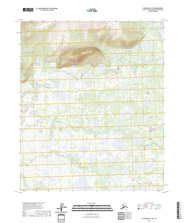
2024 Map of Livengood A-4 SW
USGS Topo · Published 2024About this map
The Tatalina River meanders through this interior Alaska landscape, defining a complex hydrologic network of wetlands and seasonal drainages. The terrain transition is sharp, shifting from the low-lying basin of the Chatanika River in the south to the elevated topographic relief of the northern hills. These upland sections, marked by steep contour lines, contrast with the expansive marshlands that dominate the central portion of the survey. Remote and largely undeveloped, the area is partitioned by the Washington Creek drainage, which flows through the eastern sections. The map reveals the intricate natural patterns of a subarctic wilderness, documenting the precise path of waterways and the underlying Public Land Survey System boundaries, including t3n r7w and t2n r6w, which orient the vast stretch of uninhabited territory between the river valleys.
Find a feature on this map
8 named features on this map. Tap any name to fly to it.
Don’t see what you’re looking for? This feature index may not catch every label — zoom into the map to look around manually.
Map Details
Editions of this 2024 Livengood A-4 SW Map
This is the sole edition of this map. No revisions or reprints were ever made.
Other maps of this area

1945 · Livengood
USGS Topo · 1:250,000

1949 · Fairbanks D-4
USGS Topo · 1:63,360

1950 · Fairbanks
USGS Topo · 1:250,000

1950 · Fairbanks D-5
USGS Topo · 1:63,360

1951 · Fairbanks
USGS Topo · 1:250,000

1951 · Livengood
USGS Topo · 1:250,000

1951 · Livengood A-5
USGS Topo · 1:63,360

1951 · Livengood A-4
USGS Topo · 1:63,360

1952 · Fairbanks D-4
USGS Topo · 1:63,360

1952 · Fairbanks
USGS Topo · 1:250,000