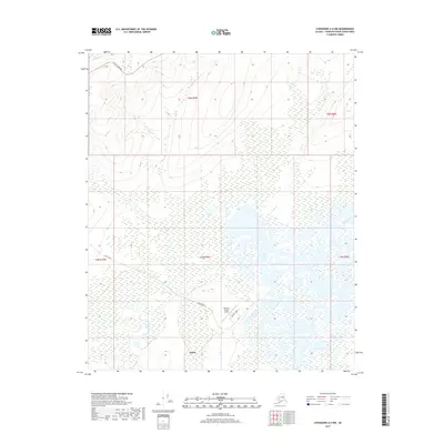
2017 Map of Livengood A-5 NW
USGS Topo · Published 2017About this map
Minto serves as the central hub of this sub-arctic landscape, situated near the winding course of the Tolovana River. The settlement is defined by its strategic connection to the interior via Minto Road, which branches off the primary artery of the Elliott Highway to the north. Transportation and logistics for this remote area are anchored by the Minto Al Wright Airport, located just east of the village core and accessed via Airport Street. The surrounding terrain is a complex network of wetlands and drainage systems, characterized by meandering waterways such as Uncle Sam Creek, Moose Creek, and Montana Creek. These seasonal flows and permanent marshlands illustrate the seasonal nature of travel and subsistence in the Tanana Valley region during the early twenty-first century.
Find a feature on this map
14 named features on this map. Tap any name to fly to it.
Don’t see what you’re looking for? This feature index may not catch every label — zoom into the map to look around manually.
Map Details
Editions of this 2017 Livengood A-5 NW Map
This is the sole edition of this map. No revisions or reprints were ever made.
Other maps of this area

1945 · Livengood
USGS Topo · 1:250,000

1951 · Livengood
USGS Topo · 1:250,000

1951 · Livengood A-5
USGS Topo · 1:63,360

1952 · Livengood A-6
USGS Topo · 1:63,360

1952 · Livengood B-5
USGS Topo · 1:63,360

1953 · Livengood A-6
USGS Topo · 1:63,360
1954 · Livengood A-5
USGS Topo · 1:63,360

1956 · Livengood B-6
USGS Topo · 1:63,360

1956 · Livengood
USGS Topo · 1:250,000

1964 · Livengood
USGS Topo · 1:250,000