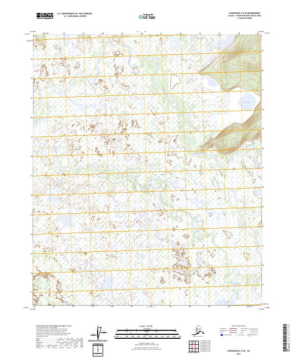
2024 Map of Livengood A-5 SE
USGS Topo · Published 2024About this map
The Tatalina River and Chatanika River define the intricate drainage patterns of this Alaskan interior landscape in the Yukon-Koyukuk Census Area. This 2024 survey captures the meandering courses of these significant waterways as they navigate through a terrain dominated by low-lying wetlands and complex hydrography. To the east, the elevation shifts significantly toward a series of ridgelines, where Cod Lake sits at the base of rising slopes. The confluence of smaller tributaries like Washington Creek into the larger river systems highlights the seasonal water flow and traditional transport corridors of the region. The map provides a contemporary view of the Public Land Survey System divisions, including t3n r8w and t3n r7w, which frame the undeveloped character of the Alaska wilderness north of Fairbanks.
Find a feature on this map
9 named features on this map. Tap any name to fly to it.
Don’t see what you’re looking for? This feature index may not catch every label — zoom into the map to look around manually.
Map Details
Editions of this 2024 Livengood A-5 SE Map
This is the sole edition of this map. No revisions or reprints were ever made.
Other maps of this area

1945 · Livengood
USGS Topo · 1:250,000

1949 · Fairbanks D-4
USGS Topo · 1:63,360

1950 · Fairbanks
USGS Topo · 1:250,000

1950 · Fairbanks D-5
USGS Topo · 1:63,360

1951 · Fairbanks
USGS Topo · 1:250,000

1951 · Livengood
USGS Topo · 1:250,000

1951 · Livengood A-5
USGS Topo · 1:63,360

1951 · Livengood A-4
USGS Topo · 1:63,360

1952 · Fairbanks D-4
USGS Topo · 1:63,360

1952 · Fairbanks
USGS Topo · 1:250,000