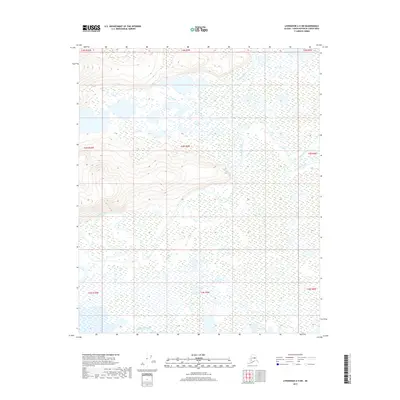
2017 Map of Livengood A-5 SW
USGS Topo · Published 2017About this map
Tolovana River and the Chatanika River converge within this expanse of the Alaska interior, creating a complex hydrologic landscape defined by seasonal wetlands and shifting watercourses. The territory is dominated by the broad, low-lying drainage basins of these rivers, which are joined by the Tatalina River in the eastern reaches. The presence of Swanneck Slough in the southwest highlights the intricate network of side channels and backwaters typical of this riverine environment. While topographical relief is minimal across much of the quadrangle, the survey documents the vast aquatic systems that dictated the routes of early travel and traditional use in the Unorganized Borough long before modern infrastructure reached this part of the Yukon-Koyukuk Census Area.
Find a feature on this map
13 named features on this map. Tap any name to fly to it.
Don’t see what you’re looking for? This feature index may not catch every label — zoom into the map to look around manually.
Map Details
Editions of this 2017 Livengood A-5 SW Map
This is the sole edition of this map. No revisions or reprints were ever made.
Other maps of this area

1945 · Livengood
USGS Topo · 1:250,000

1950 · Fairbanks
USGS Topo · 1:250,000

1950 · Fairbanks D-5
USGS Topo · 1:63,360

1951 · Fairbanks
USGS Topo · 1:250,000

1951 · Livengood
USGS Topo · 1:250,000

1951 · Livengood A-5
USGS Topo · 1:63,360

1952 · Livengood A-6
USGS Topo · 1:63,360

1952 · Fairbanks
USGS Topo · 1:250,000
1952 · Fairbanks D-6
USGS Topo · 1:63,360

1953 · Livengood A-6
USGS Topo · 1:63,360