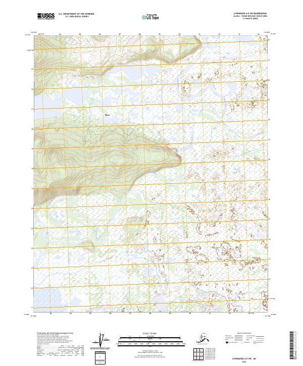
2024 Map of Livengood A-5 SW
USGS Topo · Published 2024About this map
Minto sits at the edge of a massive wetland complex where the Tolovana River meanders through the interior Alaska landscape. This 2024 survey captures the intricate water network of the Tanana Valley, where the Chatanika River and Tatalina River converge amidst a labyrinth of lakes and marshland. The terrain is characterized by dramatic shifts between low-lying basins and sudden elevations, such as the prominent ridge systems rising west of the river basins. The presence of Swanneck Slough and countless unnamed water bodies highlights the seasonal dynamism of this subarctic environment, vital for local subsistence and navigation. The map's layout across several townships including t3n r9w and t2n r9w underscores the vast, undeveloped character of the Yukon-Koyukuk region, where traditional land use remains closely tied to these specific waterway corridors.
Find a feature on this map
12 named features on this map. Tap any name to fly to it.
Don’t see what you’re looking for? This feature index may not catch every label — zoom into the map to look around manually.
Map Details
Editions of this 2024 Livengood A-5 SW Map
This is the sole edition of this map. No revisions or reprints were ever made.
Other maps of this area

1945 · Livengood
USGS Topo · 1:250,000

1950 · Fairbanks
USGS Topo · 1:250,000

1950 · Fairbanks D-5
USGS Topo · 1:63,360

1951 · Fairbanks
USGS Topo · 1:250,000

1951 · Livengood
USGS Topo · 1:250,000

1951 · Livengood A-5
USGS Topo · 1:63,360

1952 · Livengood A-6
USGS Topo · 1:63,360

1952 · Fairbanks
USGS Topo · 1:250,000
1952 · Fairbanks D-6
USGS Topo · 1:63,360

1953 · Livengood A-6
USGS Topo · 1:63,360