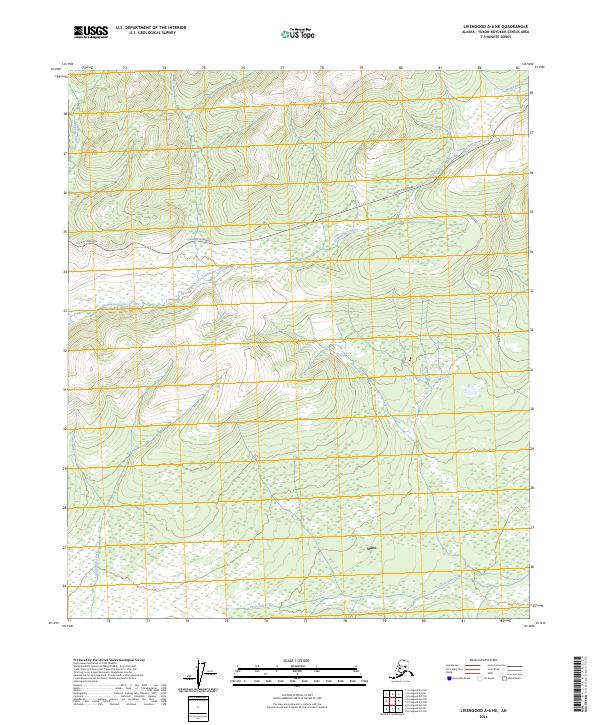
2024 Map of Livengood A-6 NE
USGS Topo · Published 2024About this map
Minto serves as a focal point in this interior Alaskan landscape, situated among the extensive wetlands and winding waterways of the Yukon-Koyukuk region. The settlement is connected to the broader territory via Minto Road, which strikes north toward the Elliott Highway. The terrain is defined by a complex drainage system, where the waters of Hutlitakwa Creek and Uncle Sam Creek meander through low-lying flats. To the north, the landscape rises toward higher ground drained by Moose Creek, while Applegate Creek and Kochenyath Creek define the western reaches of the quadrangle. This map illustrates the vital relationship between remote Alaskan communities and the seasonal water and road networks that sustain them, showing how modern infrastructure like the Elliott Highway intersects with traditional land use in the Tanana Valley area.
Find a feature on this map
12 named features on this map. Tap any name to fly to it.
Don’t see what you’re looking for? This feature index may not catch every label — zoom into the map to look around manually.
Map Details
Editions of this 2024 Livengood A-6 NE Map
This is the sole edition of this map. No revisions or reprints were ever made.
Other maps of this area

1945 · Livengood
USGS Topo · 1:250,000

1951 · Livengood
USGS Topo · 1:250,000

1951 · Livengood A-5
USGS Topo · 1:63,360

1952 · Livengood A-6
USGS Topo · 1:63,360

1952 · Livengood B-5
USGS Topo · 1:63,360

1953 · Livengood A-6
USGS Topo · 1:63,360
1954 · Livengood A-5
USGS Topo · 1:63,360

1956 · Livengood B-6
USGS Topo · 1:63,360

1956 · Livengood
USGS Topo · 1:250,000

1964 · Livengood
USGS Topo · 1:250,000