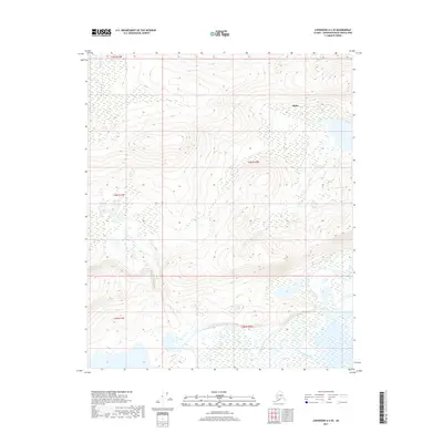
2017 Map of Livengood A-6 SE
USGS Topo · Published 2017About this map
The community of Minto sits along the northern edge of this interior landscape, marking a significant site of settlement within the Yukon-Koyukuk region. This 2017 survey documents the winding path of the Tolovana River as it meanders through the southern sections, creating a complex network of wetlands and oxbows typical of the Tanana Valley lowlands. The terrain is characterized by a stark transition from the higher elevations of the surrounding hills to the saturated river flats, a pattern that has historically influenced travel and subsistence in this part of Alaska. For those tracking the geographic evolution of the Minto Flats area, this map provides a precise record of the hydrography and public land divisions, including t3n r10w and t2n r11w, before natural shifts in the river's course alter the local topography.
Find a feature on this map
7 named features on this map. Tap any name to fly to it.
Don’t see what you’re looking for? This feature index may not catch every label — zoom into the map to look around manually.
Map Details
Editions of this 2017 Livengood A-6 SE Map
This is the sole edition of this map. No revisions or reprints were ever made.
Other maps of this area

1945 · Livengood
USGS Topo · 1:250,000

1950 · Fairbanks
USGS Topo · 1:250,000

1950 · Fairbanks D-5
USGS Topo · 1:63,360

1951 · Fairbanks
USGS Topo · 1:250,000

1951 · Livengood
USGS Topo · 1:250,000

1951 · Livengood A-5
USGS Topo · 1:63,360

1952 · Livengood A-6
USGS Topo · 1:63,360

1952 · Fairbanks
USGS Topo · 1:250,000
1952 · Fairbanks D-6
USGS Topo · 1:63,360

1953 · Livengood A-6
USGS Topo · 1:63,360