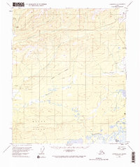
1953 Map of Livengood A-6
USGS Topo · Published 1973About this map
Hutlinana Hot Spring sits at the northwestern edge of this interior landscape, which was being mapped for modern infrastructure in the early 1950s. The terrain is defined by the winding course of the Tolovana River and the complex drainage of Swanneck Slough in the south. Evidence of mid-century development appears in the Proposed Highway Alignment cutting east-to-west across the central hills, supplemented by a network of Tractor Trails and a remote Landing Strip. Historically, the map documents several creek systems including Hutlitakwa Creek, Applegate Creek, and Uncle Sam Creek. The presence of a Pingo and the broad Dugan Hills illustrates the distinct subarctic topography of the region, while isolated structures like a Cabin mark the sparse human footprint at the time of the 1952 aerial survey.
Find a feature on this map
17 named features on this map. Tap any name to fly to it.
Don’t see what you’re looking for? This feature index may not catch every label — zoom into the map to look around manually.
Map Details
Editions of this 1953 Livengood A-6 Map
3 editions found

Other maps of this area

1945 · Livengood
USGS Topo · 1:250,000

1948 · Kantishna River
USGS Topo · 1:250,000

1950 · Fairbanks
USGS Topo · 1:250,000

1950 · Fairbanks D-5
USGS Topo · 1:63,360

1951 · Kantishna River
USGS Topo · 1:250,000

1951 · Fairbanks
USGS Topo · 1:250,000

1951 · Tanana
USGS Topo · 1:250,000

1951 · Livengood
USGS Topo · 1:250,000

1951 · Livengood A-5
USGS Topo · 1:63,360

1952 · Tanana A-1
USGS Topo · 1:63,360