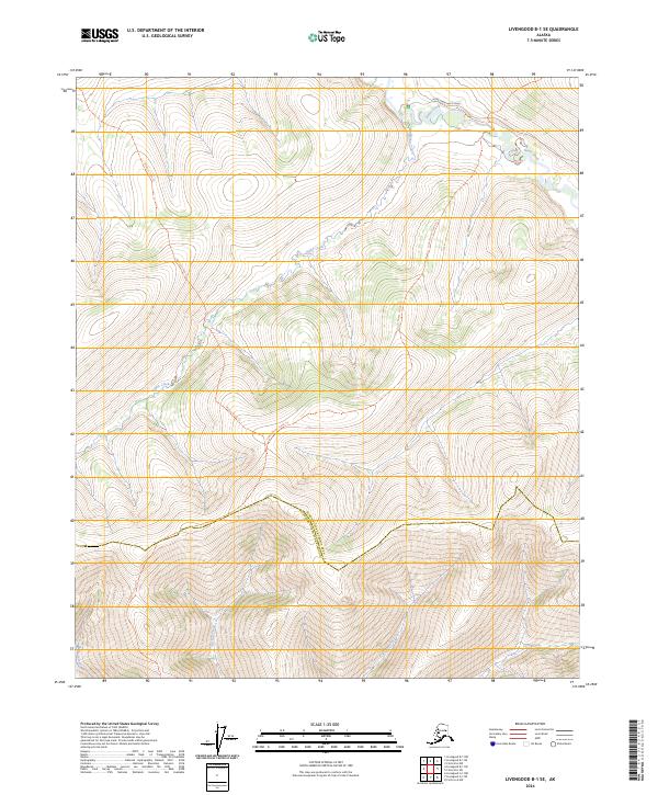
2024 Map of Livengood B-1 SE
USGS Topo · Published 2024About this map
The White Mountains National Recreation Area dominates this Interior Alaska landscape, where the boundary between the Yukon-Koyukuk Census Area and Fairbanks North Star Borough cuts through high-altitude terrain. The drainage network is central to the area's geography, with Nome Creek winding through the northern sections near the Nome Creek West Road. This 2024 survey details the primitive transportation corridors that provide access to this wilderness, including the McKay Creek Trl and the Lower Nome Creek Trl. The map illustrates a complex hydrographic system defined by Ophir Creek, Boston Creek, and the small Belle Lake, offering a precise look at the watershed before these seasonal flows reach larger river systems.
Find a feature on this map
17 named features on this map. Tap any name to fly to it.
Don’t see what you’re looking for? This feature index may not catch every label — zoom into the map to look around manually.
Map Details
Editions of this 2024 Livengood B-1 SE Map
This is the sole edition of this map. No revisions or reprints were ever made.
Other maps of this area

1945 · Livengood
USGS Topo · 1:250,000

1951 · Livengood
USGS Topo · 1:250,000

1951 · Circle
USGS Topo · 1:250,000

1952 · Livengood A-1
USGS Topo · 1:63,360

1954 · Circle A-6
USGS Topo · 1:63,360

1954 · Circle B-6
USGS Topo · 1:63,360

1954 · Livengood B-1
USGS Topo · 1:63,360
1954 · Livengood A-1
USGS Topo · 1:63,360

1955 · Circle
USGS Topo · 1:250,000

1956 · Livengood
USGS Topo · 1:250,000