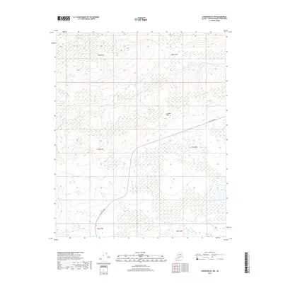
2017 Map of Livengood B-4 NW
USGS Topo · Published 2017About this map
The W Fork Tolovana River snakes through this Interior Alaska landscape, flanked by extensive wetlands and high ground. Most of the terrain is defined by the elevation of Cascaden Ridge in the central portion of the quadrangle, which provides a natural barrier between the river valley and the southeastern lowlands. Human presence is concentrated along the Elliott Highway, which cuts across the southern and eastern sections, providing the primary corridor for transportation through this part of the Yukon-Koyukuk Census Area. Apart from this roadway, the map depicts an environment dominated by watercourses like Lost Cr and Brooks Cr. The pattern of the land illustrates the isolation and seasonal hydrology characteristic of the region north of Fairbanks, where development is strictly tied to the few established overland routes.
Find a feature on this map
11 named features on this map. Tap any name to fly to it.
Don’t see what you’re looking for? This feature index may not catch every label — zoom into the map to look around manually.
Map Details
Editions of this 2017 Livengood B-4 NW Map
This is the sole edition of this map. No revisions or reprints were ever made.
Other maps of this area

1945 · Livengood
USGS Topo · 1:250,000

1951 · Livengood
USGS Topo · 1:250,000

1952 · Livengood C-5
USGS Topo · 1:63,360

1952 · Livengood B-5
USGS Topo · 1:63,360

1952 · Livengood C-4
USGS Topo · 1:63,360

1953 · Livengood B-4
USGS Topo · 1:63,360

1954 · Livengood C-4
USGS Topo · 1:63,360

1956 · Livengood
USGS Topo · 1:250,000

1964 · Livengood
USGS Topo · 1:250,000
2017 · Livengood B-5 SE
USGS Topo · 1:25,000