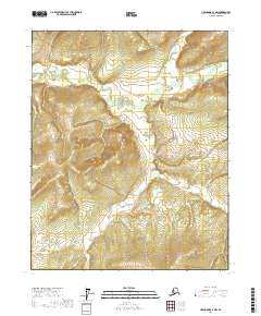
2017 Map of Livengood C-3 NW
USGS Topo · Published 2017About this map
The Hess Cr drainage network dominates this interior Alaskan landscape within the Livengood region. This 2017 survey details a remote watershed where the main stem of Hess Cr is joined by the N Fork Hess Cr and S Fork Hess Cr. The terrain is characterized by a dense system of tributary streams including Bear Cr, Wolf Cr, and Moose Cr to the east, while Wilson Cr and McHugh Cr flow through the western sections. The absence of roads or established settlements emphasizes the wilderness character of the Yukon-Koyukuk Census Area, showing a landscape defined entirely by its natural hydrology and high-elevation relief. Geologists and surveyors have carefully mapped the intersecting headwaters of Patterson Cr and California Cr, providing a precise record of the upland drainage patterns that feed into the larger river systems of the Alaska interior.
Find a feature on this map
23 named features on this map. Tap any name to fly to it.
Don’t see what you’re looking for? This feature index may not catch every label — zoom into the map to look around manually.
Map Details
Editions of this 2017 Livengood C-3 NW Map
This is the sole edition of this map. No revisions or reprints were ever made.
Other maps of this area

1945 · Livengood
USGS Topo · 1:250,000

1951 · Livengood
USGS Topo · 1:250,000

1951 · Livengood D-3
USGS Topo · 1:63,360

1952 · Livengood C-4
USGS Topo · 1:63,360

1953 · Livengood D-4
USGS Topo · 1:63,360

1954 · Livengood D-4
USGS Topo · 1:63,360

1954 · Livengood C-4
USGS Topo · 1:63,360
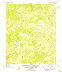
1954 · Livengood C-3
USGS Topo · 1:63,360
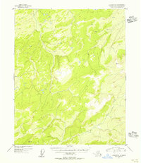
1954 · Livengood D-3
USGS Topo · 1:63,360

1956 · Livengood
USGS Topo · 1:250,000