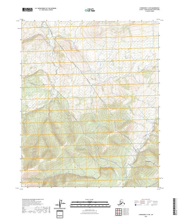
2024 Map of Livengood C-4 SW
USGS Topo · Published 2024About this map
Livengood serves as a primary reference point in this interior Alaska landscape, situated near the intersection of vital infrastructure and natural drainage systems. The Dalton Highway winds through the southern and western portions of the quadrangle, paralleled by the critical corridor of the Alaska Pipeline. This modern infrastructure cuts across a terrain defined by significant elevation changes and seasonal watercourses, including the headwaters and runs of Erickson Creek and Lost Creek. The map reflects the complex relationship between industrial logistics and the subarctic environment, where the maintenance of the pipeline and the primary northern highway dictate the human presence. Researchers can trace the path of these engineering feats as they navigate the ridges and valleys of the Yukon-Koyukuk region, providing a clear view of the state's logistical backbone.
Find a feature on this map
9 named features on this map. Tap any name to fly to it.
Don’t see what you’re looking for? This feature index may not catch every label — zoom into the map to look around manually.
Map Details
Editions of this 2024 Livengood C-4 SW Map
This is the sole edition of this map. No revisions or reprints were ever made.
Other maps of this area

1945 · Livengood
USGS Topo · 1:250,000

1951 · Livengood
USGS Topo · 1:250,000

1952 · Livengood C-5
USGS Topo · 1:63,360

1952 · Livengood B-5
USGS Topo · 1:63,360

1952 · Livengood C-4
USGS Topo · 1:63,360

1953 · Livengood B-4
USGS Topo · 1:63,360

1954 · Livengood C-4
USGS Topo · 1:63,360

1956 · Livengood
USGS Topo · 1:250,000

1964 · Livengood
USGS Topo · 1:250,000
2017 · Livengood C-5 NE
USGS Topo · 1:25,000