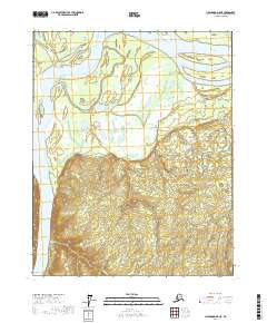
2017 Map of Livengood D-5 NE
USGS Topo · Published 2017About this map
Stevens Village sits on the northern bank of the Yukon River, serving as a primary focal point in this portion of the Yukon-Koyukuk region. The landscape is dominated by the braided channels and wide floodplains of the river, which creates distinct features like Theodore Island. This 2017 survey illustrates the complex hydrology of the area, where the main river body interacts with smaller tributaries such as Hamlin Cr. The topography south of the river rises into a series of interior ridges, contrasting with the low-lying wetlands and seasonal drainages closer to the water. The map's layout highlights the traditional river-oriented settlement patterns common in this part of Alaska, where the waterway provides the essential corridor for transport and subsistence.
Find a feature on this map
10 named features on this map. Tap any name to fly to it.
Don’t see what you’re looking for? This feature index may not catch every label — zoom into the map to look around manually.
Map Details
Editions of this 2017 Livengood D-5 NE Map
This is the sole edition of this map. No revisions or reprints were ever made.
Other maps of this area

1945 · Livengood
USGS Topo · 1:250,000

1951 · Livengood
USGS Topo · 1:250,000

1951 · Beaver
USGS Topo · 1:250,000

1952 · Livengood D-5
USGS Topo · 1:63,360

1953 · Livengood D-4
USGS Topo · 1:63,360

1954 · Livengood D-4
USGS Topo · 1:63,360

1956 · Beaver A-5
USGS Topo · 1:63,360

1956 · Beaver
USGS Topo · 1:250,000

1956 · Beaver A-4
USGS Topo · 1:63,360

1956 · Livengood
USGS Topo · 1:250,000