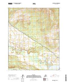
2017 Map of Livengood D-6 NW
USGS Topo · Published 2017About this map
The Alaska Pipeline cuts a distinct diagonal path across this subarctic terrain, following a corridor shared with the Dalton Highway. This industrial lifeline is the defining human element in a landscape dominated by the winding hydrology of the Yukon-Koyukuk region. In the south, the massive Yukon River flows through the corner of the sheet, while the Ray River and Big Salt River meander through broad, marshy valleys defined by complex wetland networks. The orientation of the pipeline and highway relative to these waterways illustrates the engineering challenges of navigating the interior's drainage basins. These transportation and energy arteries represent the primary modern infrastructure in an area otherwise characterized by vast stretches of wilderness and seasonal water cycles.
Find a feature on this map
13 named features on this map. Tap any name to fly to it.
Don’t see what you’re looking for? This feature index may not catch every label — zoom into the map to look around manually.
Map Details
Editions of this 2017 Livengood D-6 NW Map
This is the sole edition of this map. No revisions or reprints were ever made.
Other maps of this area

1945 · Livengood
USGS Topo · 1:250,000

1951 · Bettles
USGS Topo · 1:250,000

1951 · Tanana
USGS Topo · 1:250,000

1951 · Livengood
USGS Topo · 1:250,000

1951 · Beaver
USGS Topo · 1:250,000

1956 · Bettles
USGS Topo · 1:250,000

1956 · Beaver
USGS Topo · 1:250,000

1956 · Livengood D-6
USGS Topo · 1:63,360

1956 · Tanana D-1
USGS Topo · 1:63,360

1956 · Livengood
USGS Topo · 1:250,000